Thursday, August 28, 2014

Life along the Ganges

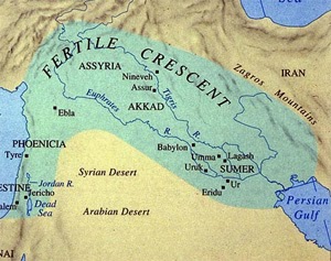
The great river valleys and cultures
Egypt, Mesopotamia, Indus river valley and China.


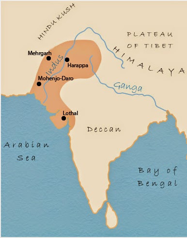
Indian civilization shift from Indus basin to Ganges basin
The disintegration of the Harappan civilization (http://sciencedoing.blogspot.in/2014/04/indus-valley-civilization-collapse.html), in the early 2nd millennium BC, mark the point when the center of Indian civilization shifted from the Indus basin to the Ganges basin.*

There may be links between the Late Harappan settlement of the Ganges basin and the archaeological culture known as "Cemetery H", the Indo-Aryan people, and the Vedic period (http://sciencedoing.blogspot.in/2012/09/exploring-lost-places-indus-valley.html).

Early Vedic age and Ganges
During the early Vedic Age of the Rigveda (http://sciencedoing.blogspot.in/2013/01/the-vedic-god-agni.html), the Indus and the Sarasvati River (http://sciencedoing.blogspot.in/2013/01/saraswati-lost-river-of-india.html) were the major sacred rivers, not the Ganges. 

But the later three Vedas give much more importance to the Ganges. The Gangetic Plain became the centre of successive powerful states, from the Maurya Empire to the Mughal Empire.

Ganges is the longest river in India 
The river has the second greatest water discharge in the world and its basin is the most heavily populated in the world with over 400 million people living in the basin.

Ganges and Hinduism
The 2,525 km (1,569 mi) river rises in the western Himalayas in the Indian state. The Ganges is the most sacred river to Hindus. It is also a lifeline to millions of Indians who live along its course and depend on it for their daily needs. It is worshipped as the goddess Ganga in Hinduism.

Ganges from Himalayan valley to Gangetic plain
After flowing 250 kilometres (160 mi) through its narrow Himalayan valley, the Ganges emerges from the mountains at Rishikesh, then debouches onto the Gangetic Plain at the pilgrimage town of Haridwar.

At Haridwar, a dam diverts some of its waters into the Ganges Canal (http://throughpicture.blogspot.in/2014/01/proby-cautley-ganges-canal-in-india.html), which irrigates the Doab region of Uttar Pradesh, whereas the river, whose course has been roughly southwest until this point, now begins to flow southeast through the plains of northern India.

Life along the Ganges in Rishikesh and Haridwar
A pictorial tribute to this grand river of India, deep in the their religious conscience, flowing through the coast of Rishikesh and Haridwar:

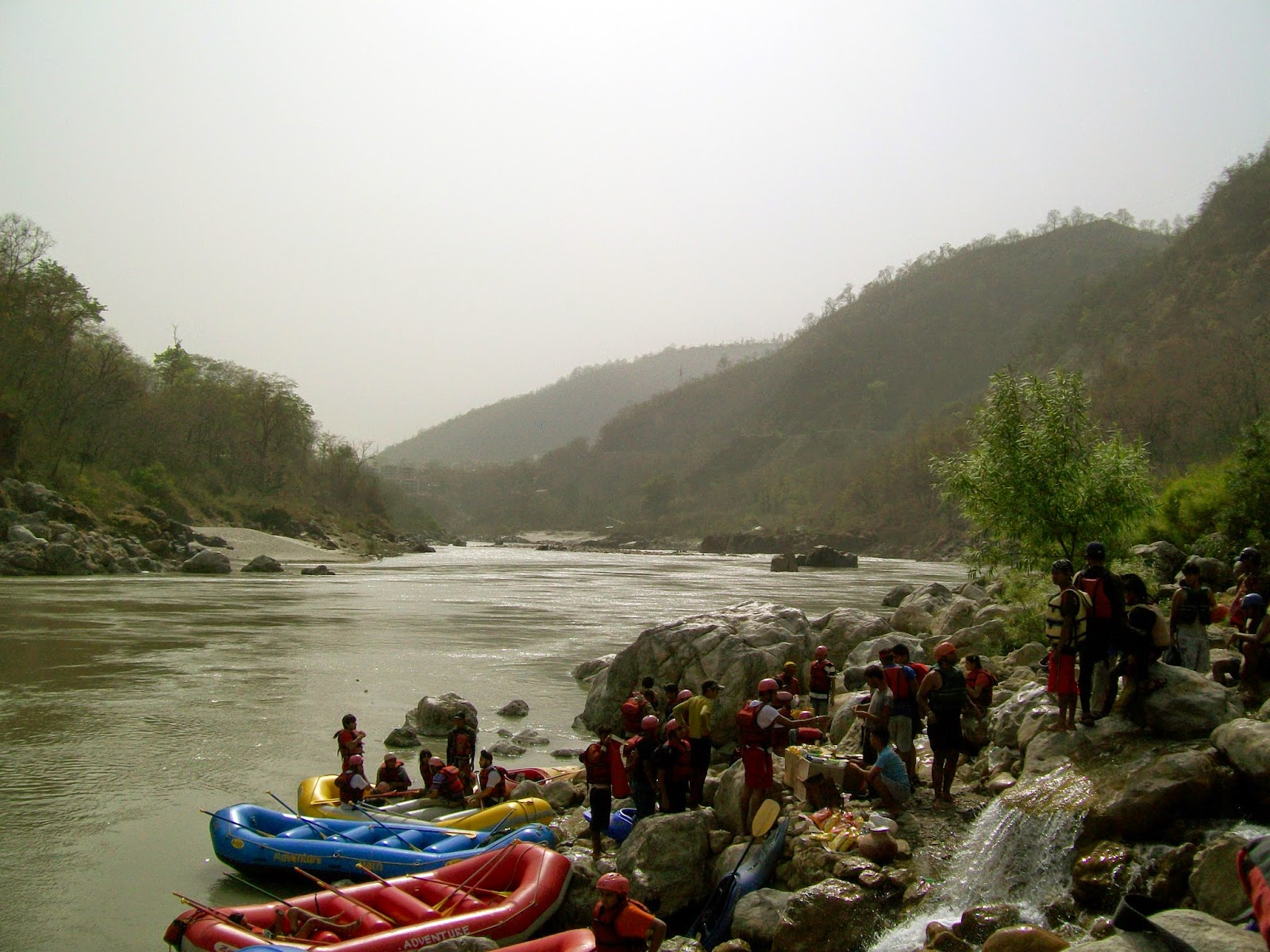
Holy Ganges river of India witnesses varying activity along it's coast. White water rafting is another recreation for youngsters, in rapids of various grades in higher reaches of Himalayan.

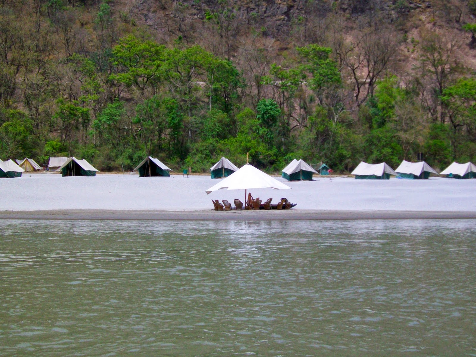
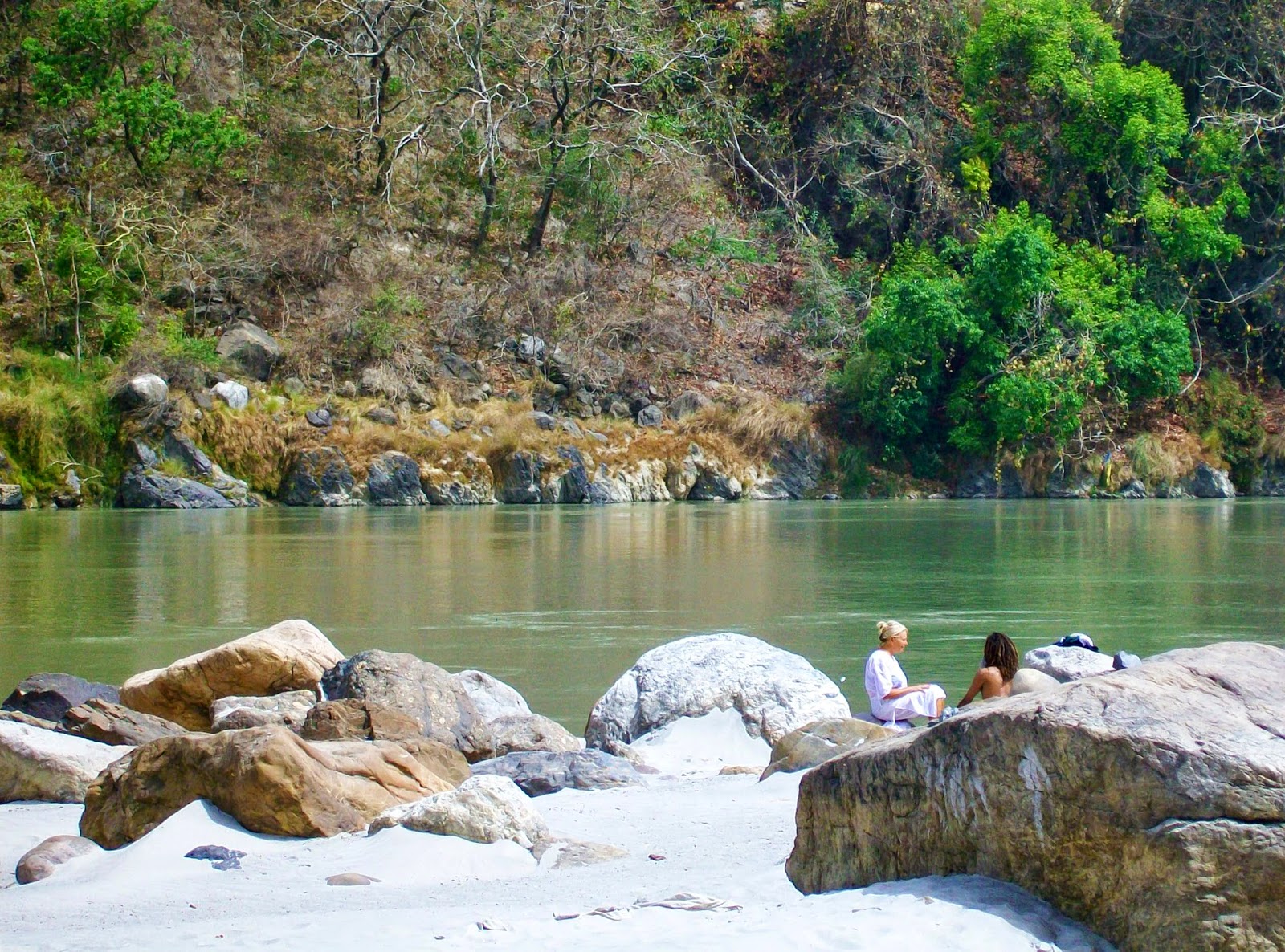
White sand beach camp along Ganges in Rishikesh is another way to enjoy the natural and beautiful stay near this holy river.

Rishikesh is a place where Ganges appears from the Himalayan range into plains. There this river regarded as the most Holy, witnesses many human emotions performed at it's bank since ages.

 Rishikesh is considered by Hindus to be a holy city and is vegetarian by law.

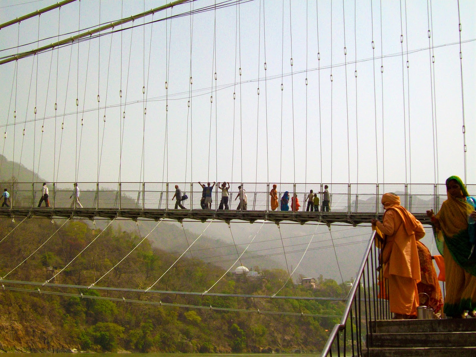
An iron suspension bridge made over river Ganges to cross the river and is a landmark of Rishikesh.

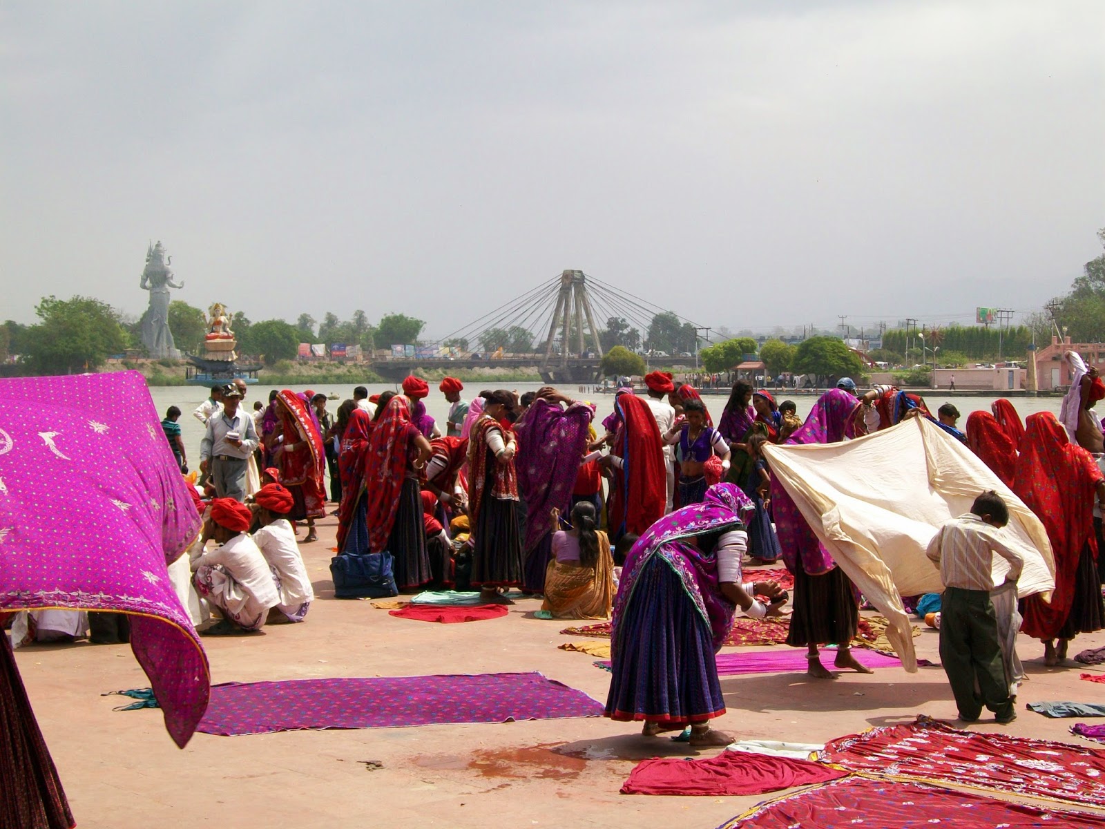
 Haridwar is regarded as one of the seven holiest places to Hindus.

Holy dip in the Ganges at Haridwar.


 *a pictorial reference (in Hindi) about lost saraswati river:http://hindi.speakingtree.in/spiritual-slideshow/seekers/mysticism/content-380784/181484
#rishikesh and haridwar pictures belongs to author of this blog.
#river valley culture maps thankfully shared from:http://campusguides.stjohns.edu/content.php?pid=179056&sid=1507644
#textual reference thankfully shared from:http://en.wikipedia.org/

Friday, August 22, 2014

Satellite images of India

India from space

This week most of the on line editions of national news papers 
covered a report about India's satellite images, 
which were thankfully received from: 
nasa.gov
ISS
Chandrayaan-1
Mangalyaan
ISRO
******
These images are very interesting as they show:
Indo-Pak border that is lit by floodlights. 
The floodlights dot the border in Gujarat to prevent smuggling and arms trafficking.
 (certain borders are fortified more than others. The US-Mexican border, the India-Pakistan border, the separation wall between Israel and the Palestinian territories, and the demilitarized zone between North and South Korea are among the places where the toughest national security and anti-movement policies are in force.
The border between these two countries is hotly contested, especially in the region of Kashmir. India is also wary of terrorist infiltration along the entire border. Sometimes called the “Berlin Wall of Asia”, the border has only one road crossing. Half of the border is floodlit, and hence can be seen from space.)

NASA has also captured some amazing photos 
of the Sundarbans area and the Ganges valley in Brahmputra.

These unseen photos of India from space show cities 
like Mumbai and Delhi, forest fires, and lakes. 
There are also images of India taken from Indian satellites Chandrayaan and Mangalyaan here. 
(shared thankfully from: http://ibnlive.in.com/news/)


Photograph taken from International Space Station, you can clearly see border between India and Pakistan due to special security lighting in orange. The Indian government sanctioned a move to erect floodlights along the terrain separating India and Pakistan in the Gujarat sector in 2003 to prevent smuggling and arms trafficking. Courtesy: ISS


his image of New Delhi was captured by the Advanced Spaceborne Thermal Emission and Reflection Radiometer (ASTER) on NASA’s Terra satellite on September 22, 2003. The dramatic differences in the landscapes tell some of the city’s history. Little vegetation interrupted the urban expanse. In contrast, the buildings of New Delhi were laid out along wide, tree-lined avenues that connected monuments, parks, and government buildings. Among the most obvious of these avenues is the Rajpath, visible as a green strip across the heart of New Delhi. The Rajpath connects the grounds of the President’s estate on the west to the India Gate (a World War I memorial) on the east. To the west of New Delhi is the Central Ridge Forest Reserve, which gives a hint of how the landscape would have looked before human development. Courtesy: nasa.gov


In this true-color MODIS image from October 23, 2001, the semi-arid Tibetan Plateau (upper left) meets up with the Himalayas to the south. From the heights of the Himalayas, snow-covered on their northern flanks, and lush with vegetation to the south, numerous rivers, brown with churned up sediment, flow into the valley of the Brahmaputra River in Assam, India. Courtesy: nasa.gov


India’s Hugli River (sometimes spelled “Hooghly”) is a Ganges River distributary, one of the many branches of the river that are collectively known as the “Mouths of the Ganges.” As the Ganges approaches the coastal plain, the river fans out over the flat terrain of Bangladesh and West Bengal, India, as numerous meandering channels. The Hugli branches off the Ganges about 200 kilometers north of Calcutta, and the river flows past the city before emptying into the Bay of Bengal. Courtesy: nasa.gov


A large fire was burning in India’s Sri Venkateshwara National Park on March 24, 2014, when the Moderate Resolution Imaging Spectroradiometer (MODIS) on NASA’s Aqua satellite acquired this image. The fires are outlined in red. The park consists of dry deciduous forest, and is home to a wide range of rare wildlife, including tigers and the golden gecko. According to local news reports, several forest fires have burned in national parks and wildlife reserves in the hills of Andhra Pradesh over the past week. The protected forested land is dark green in contrast to the surrounding tan landscape. Courtesy: nasa.gov


This image, taken by astronauts aboard the International Space Station, shows Lake Sambhar’s eastern saltworks in detail. Today, they are operated by a joint venture between Hindustan Salts and the Government of Rajasthan. East of the dam is a railroad, built by the British (before India’s independence) that provides access from Sambhar Lake City to the salt works. Courtesy: nasa.gov


NASA's Aqua satellite captured an image of Tropical Cyclone Lehar after it weakened to a depression and neared the coast of India on November 29. Lehar made landfall south of Machillipatnam. Courtesy: nasa.gov


The Advanced Spaceborne Thermal Emission and Reflection Radiometer (ASTER) flying on NASA’s Terra satellite acquired this image of Lonar Crater on November 29, 2004. In this simulated-true-color image, pink-beige indicates bare ground, blue and off-white indicate human-made structures, dark blue indicates water, green indicates vegetation, and dull purple indicates fallow fields. A vegetation-lined lake fills the crater, one of the few natural features of this scene. Signs of human habitation surround the lake, especially the cluster of blue and off-white points to its immediate northeast. Outside of this settlement, the vicinity is a patchwork of agricultural fields. Courtesy: nasa.gov


This image mosaic is comprised of three astronaut photographs acquired within ten seconds of each other as the International Space Station passed over India. Almost cloud-free conditions reveal the continuous urban land cover of the megacity extending north to south across Salsette Island—a distance of nearly 50 kilometers. Sanjay Gandhi National Park, bordered on three sides by the urbanized area, is the largest national park in the world located within city limits. In addition to providing a refuge for native plants and animals (including humans), the park also includes two lakes that form part of the Mumbai drinking water system. Courtesy: nasa.gov


With its 14 spectral bands from the visible to the thermal infrared wavelength region and its high spatial resolution of 15 to 90 meters (about 50 to 300 feet), ASTER images Earth to map and monitor the changing surface of our planet. ASTER is one of five Earth-observing instruments launched Dec. 18, 1999, on Terra. The instrument was built by Japan's Ministry of Economy, Trade and Industry. A joint U.S./Japan science team is responsible for validation and calibration of the instrument and data products. Courtesy: nasa.gov


North of the Bay of Bengal in eastern India, the city of Calcutta (large purple area) hugs the eastern bank of one of the myriad channels that split off the Ganges River before it empties into the Bay. The arm of the Ganges that runs through Calcutta is known as the Hooghly River. It is the large, pale green river running through the left side of the image. Calcutta, also referred to as Kolkata, is about 100 miles north of where the Hooghly empties into the Bay via the Mouths of the Ganges. Courtesy: nasa.gov


Bangalore as seen from space. Courtesy: nasa.gov


Southern region of India with the Western Ghats and Sri Lanka. Courtesy: nasa.gov


Saser Mustagh- The Saser Muztagh is the easternmost sub range of the Karakoram range, in the Kashmir region of India. Courtesy: nasa.gov


The Palk Strait. Courtesy: nasa.gov


An aerial view of Mumbai. Courtesy: nasa.gov


The Sunderbans area of West Bengal and Bangladesh. Courtesy: nasa.gov


The Chandrayaan-1 Image: Photograph of the earth with India at its center. The photograph was taken on March 25, 2009 at 07:03:03 UTC from Chandrayaan 1 - India's first satellite to moon. Courtesy: ISRO


The Mangalyan Image: Photograph of India along with the some other parts of Asia and Africa taken by our first interplanetary space mission officially known as the Mars Orbiter Mission on November 19, 2013, from a 70,000 kilometers above Earth. Courtesy: ISRO